GIS in Orangeville
Celebrating GIS Day with
a Year-in-Review of Data Orangeville 
use the arrow keys on your computer to navigate ( )
or swipe on touch devices ( )
Begin
at the U of T campus in Mississauga during the BeSpatial'18 event.
URISA - Best Public Sector GIS
Orangeville joined the City of Brampton and the Town of East Gwillimbury to get this award.
The Best Public Sector GIS award is presented to organizations that have demonstrated
the use of GIS in improving effectiveness and efficiency in enterprise GIS for public sector operations.
URISA Awards page
Continue to the other award
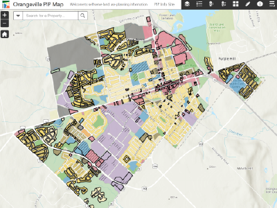
ESRI - App of the Month - June 2018
ESRI Canada picked 12 applications across Canada to showcase for each month through 2018.
PIP is the quickest way to get ample information about any property in Orangeville relating to
planning and development. This application greatly improves access to information and self service.
Read the ESRI Canada Blog Post Open the Planning Information Portal (PIP) App
Go to the next section

Tree Sculptures
Interactively explore the 52 sculptures across Orangeville and their artists.
Like and share your favorite sculptures, and check-in with Facebook.
Open the Tree Sculptures App
Go to the next app
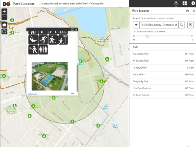
Parks and Trails
Explore parks and recreation areas around Orangeville. See which features
and ammenities are available at each location and see our great aerial photos.
Open the Park Locator App
Go to the next app
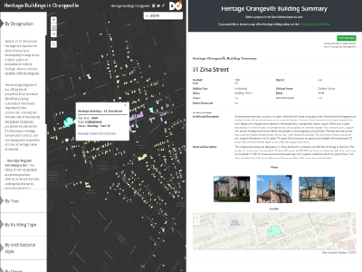
Heritage Buildings
Thanks to the Heritage Committee and valuable contributions by volunteers, the town
has a great repository of information on the heritage buildings around Orangeville.
Open the Heritage Buildings App
Go to the next section
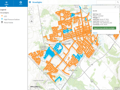
Help us monitor outages...
See all streetlights in Orangeville and let us know if something is wrong.
Open the Streetlight App
Go to the next section
GTFS
(General Transit Feed Specification)
Orangeville Transit publishes its data in the universal GTFS model.
This allows others to easily integrate our data in thier products.
For example, Orangeville Transit times and directions can be obtained directly using Google Maps.
Coming soon is real-time transit information and exact stop times based on bus locations.
What's next...
Be Aware, Get Excited!
GIS is about getting answers to those with questions.
GIS is all about the data.
We collect and manage data, ensuring quality,
and make applications that connect staff and the public to the data.
Share with us what you think Orangeville should have on the map!