Planning Information Portal
Hello, I'm PIP!
The Town of Orangeville's Planning Information Portal
I am a publicly accessible map-centric resource that allows you to easily browse municipal zoning and official plan information related to any property in the Town of Orangeville.
The map provides for simple visual investigations, while links from map selections will bring you back to this site to provide detailed zoning and official plan information.
There are tools available in the map that allow you to and toggle layers, see aerial imagery, measure distances and areas, draw, and print.
All efforts are made to ensure the accuracy of the information in this resource, that aims to increase the accessibility and useability of parts of the Town of Orangeville's Zoning and Official Plan. The Zoning and Official Plan documents contain complete and official information.
If you notice an issue with this resource please contact gis@orangeville.ca
“the mists had all solemnly risen now, and the world lay spread before me.” - Pip in Charles Dickens: Great Expectations
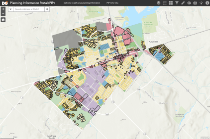
Open the Map with Zoning Layers to start Open the Map with Official Plan layers to start
Quick Start Guide
See the tips below to help get you started with the web map...
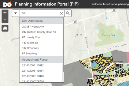
Search
As you type, the search will provide some results on the fly.
Because shortcuts are great! Nobody likes typing out the whole address (+1 for laziness/efficiency)
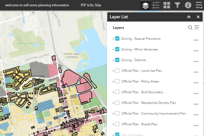
Toggle Layers
We can't have everything on the map at once, it would be too busy.
Open the Layers panel, and turn layers on and off as you need them.
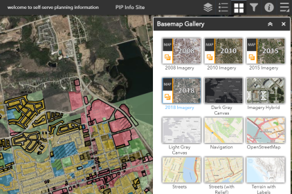
Imagery
You can change the basemap that the layers sit on top of.
The most valuable is probably the Imagery basemap.
But wait, there's more...
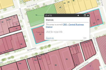
When you click on a property you are given multiple results, be sure to click the arrows to switch between them.
Some windows provide links you can click on to provide you with detailed information.